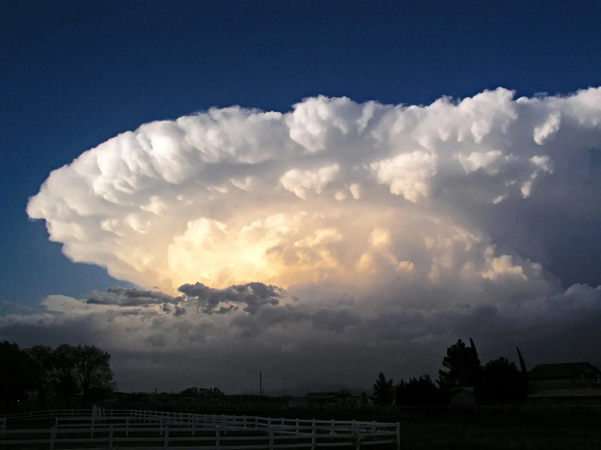
Free Hail, Wind & Storm History by Address
Built for roofers, public adjusters, claim attorneys, and homeowners: estimated hail size and peak wind gust at the property for every storm date, an Audit Report with the evidence behind any single date, and 15+ years of NOAA storm records — in all 50 states.
The storm record that backs the claim.
Check an address — free · Tools for professionals
Free account · no credit card required · covers all 50 states
- 460M+ NOAA weather data points indexed
- 15+ years of NOAA storm records (since 2010)
- 50 states covered
- Any U.S. address, down to the property
Built for the professionals who work the claim — free for homeowners
Roofers, adjusters & claim attorneys

Find the storm date, document every roof, and answer the carrier. Estimated hail and wind at the property for each date in a clean PDF for the claim file, plus an Audit Report with the instruments and arithmetic behind any single date.
- Roofing contractors
- Public adjusters
- Insurance adjusters
- Insurance claim attorneys
- Restoration contractors
- Teams & firms
Homeowners

Heard hail on the roof, or came home to shingles in the yard? Check the estimated hail size and peak winds derived for your address, plus official warnings and nearby reports — before you call anyone or file a claim.
Built for insurance claim work
What roofers, public adjusters, and claim attorneys need from a weather report — at a price that works on every job.
Find the date of loss
Ranked storm dates by state and county, a storm calendar, and a Zone Canvas that lists every storm day inside the area you draw. Date-of-loss research
Hail and wind at the property
Estimated hail size and peak wind gust at the property for every storm date — wind included, not just hail — in a branded PDF for the file. See a sample report
Show the evidence
The Audit Report lays out every instrument, its distance from the property, and the arithmetic behind a single date, so a carrier sees how the number was reached. About the Audit Report
15+ years of records
NOAA storm records since 2010 for every state and 578 cities, plus the last 12 months deduplicated from warnings, reports, and station data. Storm data by state
Priced for volume: a full report is $2.99 with no subscription. The Organization plan covers five accounts with unlimited Weather Reports and Audit Reports for $29.99/month. Compare plans
Canvass by zone, not by guesswork
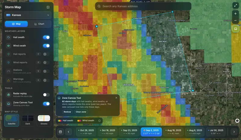
Draw a zone around a subdivision, a ZIP code, or your whole service area — up to 2,500 square miles — with four clicks on the Storm Map. The Zone Canvas Tool lists every storm day with hail swaths, wind swaths, or storm reports inside it, and the date carousel jumps straight to those days.
- Plan door-knocking around the neighborhoods a storm actually crossed
- Check a book of policies or a street of claims against the same storm days
- Then run a Weather Report on each roof for the per-address numbers
Included with Pro+ ($9.99/mo) and on every Organization account. Zone canvassing for roofers
From free answer to full report
Free Report Snapshot
A clear YES/NO for estimated hail of 0.75″ or larger and wind of 45 mph or more at your address, plus nearby station observations, warnings, and storm reports. Free on every account.
Weather Report PDF — $2.99 one-time or from $4.99/mo
The full dated history: estimated peak gust and max hail at the property for every qualifying date since October 2021 (5+ years), built on our published methodology, with a branded PDF built for claim files. Buy a single report for $2.99 with no account, or subscribe for a daily allowance.
Statewide storm tools
Hail and wind swath explorers, a storm calendar, county impact heatmaps, and a date-of-loss database — across all 50 states.
See a sample report.
Explore the tools
- Hail Report — Hail history at any address, sized in inches.
- Wind Report — Estimated peak gusts at the property, by date.
- Single Weather Report ($2.99) — The full report for one address — web, PDF, and emailed copy. No account or subscription.
- Storm Calendar (Pro) — Every storm day, statewide, at a glance. Pro plans.
- Live Radar & Storm Replay (Free) — Animated national radar, live NWS warnings, and replay of any storm day back to 2012.
- 7-Day Forecast (Free) — The official NWS point forecast for any U.S. location — alerts, hourly, and the week ahead.
- State Storm Data — Free downloadable datasets for all 50 states.
- Impact Heatmap — County-level storm activity shading for every state.
- Weather Stations Map (Free) — Live ASOS/AWOS observations with NEXRAD radar and active warning shading.
How it works
1 · Create a free account
No credit card. Takes under a minute, and the Free Report Snapshot is free on every account.
2 · Enter any U.S. address

Get a YES/NO for estimated hail of 0.75 in. or larger and wind of 45 mph or more, plus the warnings, station observations, and storm reports recorded nearby.
3 · Go deeper when you need to

Get the full per-date Weather Report PDF — one-time for $2.99, or on a plan from $4.99/mo (statewide hail & wind explorers on Pro+). Cancel anytime.
StormAuditor vs. the usual options
Built for claim professionals, free for homeowners to start, and priced so every job can carry a report.
| StormAuditor | Typical single-report services | |
|---|---|---|
| Free address check | Free Report Snapshot on every account | Rarely offered |
| Report pricing | $2.99 one-time single report, or from $4.99/mo with a daily allowance | Varies by provider |
| Coverage | All 50 states, 5+ years of address-level reports (since October 2021) | Varies by provider |
| Wind at the property | Estimated peak gust at the address for every storm date | Often hail only, or nearby reports |
| Evidence behind a date | Audit Report: instruments, distances, and arithmetic for one date | Rarely shown |
| Storm record depth | NOAA storm records since 2010 for every state and 578 cities | Varies by provider |
| Team plan | Organization: 5 accounts, unlimited reports, $29.99/mo | Often priced per seat or per report |
| Methodology | Published openly — anyone can read how values are derived | Usually proprietary |
| Statewide tools | Hail & wind explorers, impact heatmaps, DOL database, storm calendar | Typically report-only |
| Free open data | Downloadable state datasets, guides, and articles | Uncommon |
| Free radar & forecast | Live radar + storm-day replay to 2012, and 7-day NWS forecasts — no account | Usually app-locked or ad-walled |
General comparison with commonly advertised industry pricing and features as of 2026; individual services vary.
After the storm, get the record straight
Before you climb on the roof or sign anything, see the storm record and derived estimates for your address. It takes a minute and it's free. Check my address
Built on the public weather record
Our estimates are computed from public NOAA and National Weather Service data — radar, station observations, warnings, and storm reports — and our estimation methodology is published for anyone to read. StormAuditor is an independent tool, not affiliated with NOAA, the NWS, FEMA, or any insurance carrier.
- Radar-estimated hail (MRMS)
- Gridded wind analysis (URMA/HRRR)
- Station observations (ASOS/AWOS)
- NWS warnings & storm reports
- NCEI Storm Events
- Published methodology
Read the methodology and the limitations.
Storm data by state
Hail and wind history for every state — the last 12 months plus NOAA records since 2010. Free to browse, download, and cite.
Frequently asked questions
How do I find out if hail hit my house?
Create a free account and run a Free Report Snapshot on your address. It answers YES/NO for estimated hail of 0.75 in. or larger and wind of 45 mph or more using radar-estimated hail, nearby station wind observations, official warnings, and ground storm reports — and shows you the records behind the answer.
Where does the data come from?
From the public weather record: NOAA radar hail estimates (MRMS), NOAA wind analyses (URMA/HRRR), NWS warnings and Local Storm Reports, official NCEI Storm Events, hurricane tracks, and FEMA declarations — updated daily. Values in reports are derived from these inputs using our published methodology. StormAuditor is independent and not a government service.
What does the free tier include?
A free account includes the at-address Free Report Snapshot (estimated hail ≥ 0.75 in. and wind ≥ 45 mph YES/NO), the Address Lookup with NWS warnings, storm reports, and NOAA station observations at your address, the statewide Impact Heatmap, the live Weather Stations map with NEXRAD radar, and the top five dates in the Date-of-Loss Database. The live radar with storm-day replay, the 7-day NWS forecast page, the storm data pages for all 50 states with free CSV/JSON downloads, the hail size and wind speed guides, and the storm recaps are open to everyone — no account needed. The full dated Weather Report with PDF export is $2.99 one-time for a single address, or from $4.99/month on a plan.
Are there free hail maps and wind maps?
Yes — the live radar map (50-minute live loop, storm-day replay back to 2012) and the 7-day NWS forecast page are free with no account at all, and free accounts add the statewide Impact Heatmap and the live Weather Stations map, plus open city and state hail and wind history pages covering all 50 states and free hail size and wind speed guides. The full Storm Calendar is included on Pro plans ($4.99/month), and the day-by-day statewide Hail Explorer and Wind Explorer swath maps, built from NOAA radar and analysis data, are included on Pro+ ($9.99/month).
Can I look up storm history by address for a past date?
Yes — the Address Lookup shows hail, wind, and storm history at any U.S. address, and the full Weather Report documents every qualifying storm date at the property with estimated hail size and peak wind gust per date. Storm recaps and the Date-of-Loss Database help you pin down which date to research.
Is StormAuditor built for roofers and public adjusters?
Yes. Roofing contractors, public adjusters, insurance adjusters, and claim attorneys use StormAuditor to find the date of loss, document estimated hail size and peak wind gust at each property, and show the evidence behind a date with the Audit Report. A single report is $2.99; the Organization plan covers five accounts with unlimited Weather Reports and Audit Reports for $29.99/month. Homeowners can run the Free Report Snapshot on their own address at no cost.
Storm history by state
Alabama · Alaska · Arizona · Arkansas · California · Colorado · Connecticut · Delaware · Florida · Georgia · Hawaii · Idaho · Illinois · Indiana · Iowa · Kansas · Kentucky · Louisiana · Maine · Maryland · Massachusetts · Michigan · Minnesota · Mississippi · Missouri · Montana · Nebraska · Nevada · New Hampshire · New Jersey · New Mexico · New York · North Carolina · North Dakota · Ohio · Oklahoma · Oregon · Pennsylvania · Rhode Island · South Carolina · South Dakota · Tennessee · Texas · Utah · Vermont · Virginia · Washington · West Virginia · Wisconsin · Wyoming
Hail and wind history for major cities
New York, NY · Los Angeles, CA · Chicago, IL · Houston, TX · Phoenix, AZ · Philadelphia, PA · San Antonio, TX · San Diego, CA · Dallas, TX · Jacksonville, FL · Fort Worth, TX · San Jose, CA · Austin, TX · Charlotte, NC · Columbus, OH · Indianapolis, IN · San Francisco, CA · Seattle, WA · Denver, CO · Oklahoma City, OK