Mesocyclone: The Core of Severe Hail & Supercells
By StormAuditor Editorial Team · Published 2026-07-22 · Updated 2026-07-22
Based on public NOAA and National Weather Service records, published under StormAuditor's methodology and data-source standards. Radar-derived hail sizes are estimates unless attributed to a ground report.
Damage-threshold ranges in this article are general guidance synthesized from industry and federal research — IBHS building-performance research, NWS severe criteria, and product standards such as UL 2218 (hail impact resistance) and ASTM D3161/D7158 (shingle wind ratings). Actual performance depends on product rating, age, installation quality, exposure, and impact characteristics — thresholds describe when damage becomes possible, not when it occurs.
A mesocyclone is a rotating updraft within a supercell thunderstorm, vital for producing large, damaging hail. Understanding mesocyclones helps explain extreme weather phenomena.
What Is a Mesocyclone and Why Does It Matter for Hail?
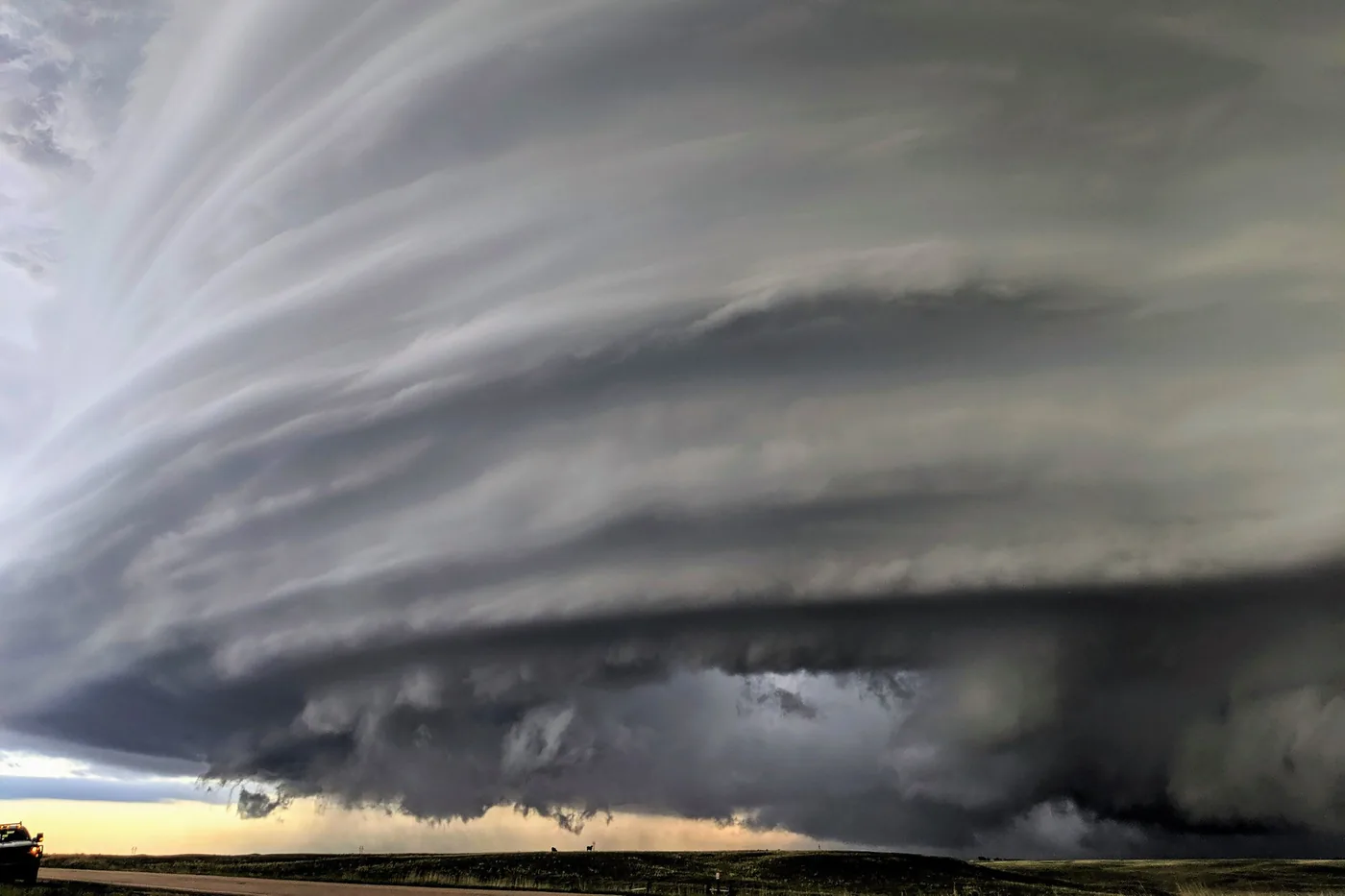
A mesocyclone is behind many of the most destructive hailstorms. It is a deep rotating updraft that lasts inside a supercell thunderstorm. This rotation gives a supercell its shape. It also gives it the power to make significant severe weather, such as large hail and tornadoes.
What Exactly Is a Mesocyclone?
A mesocyclone is a column of air that rises and spins inside a storm. It is usually 2 to 10 kilometers (1.2 to 6.2 miles) across. Here is how it forms:
- Wind shear starts the spin. Near the ground, wind changes speed and direction with height. This rolls the air into a sideways spin.
- The updraft tips it upright. The storm's strong updraft pulls in the spinning air and tilts it on end.
- The rotating updraft drives the storm. This upright spin is the mesocyclone. It powers much of the storm's severe weather.
How Do Mesocyclones Make Large Hail?
A mesocyclone is ideal for large hail. Here is why:
- Strong, steady updrafts: The rotating updraft is very strong and lasts a long time. It holds hailstones up in the storm. They rise and fall many times. Each trip picks up more supercooled water, so the stone grows.
- More time aloft: Strong updrafts keep stones from falling out too soon. This extra "residence time" in the cold upper storm lets them grow. Small ice pellets become quarter-size (1.00") hail, or even hen-egg (2.00") or tennis-ball (2.50") hail.
- Growth in cycles: Stones can loop through different parts of the storm. Each pass through supercooled water adds a new layer of ice, much like the rings of an onion.
In the end, the stones get too heavy for the updraft and fall. They often damage property:
- Asphalt shingles can show functional damage from hail about 1.00" to 1.25" across.
- Metal roofs may dent cosmetically from hail 1.00" and larger.
- Window and skylight breakage becomes more common with hail 1.75" and larger.
How StormAuditor Estimates Hail
StormAuditor gives historical hail estimates for any property. Our method is SAHE-2 (Storm Auditor Hail Estimate v2). Its main source is MRMS MESH (Maximum Estimated Size of Hail). This radar product gives a hail size estimate for each grid cell across a swath.
We also check the radar against SPC (Storm Prediction Center) reports of hail seen on the ground, and against NWS severe thunderstorm warnings. The estimate is set only when your property sits inside a swath cell; cells within ¼ mile are shown as nearby context. This is the basis for date-of-loss research. Learn more in our hail methodology.
Practical Guidance for Property Owners, Contractors, and Adjusters
Knowing how mesocyclones work helps you decide what to do after a storm:
- Property owners: Did a supercell thunderstorm that could form a mesocyclone pass over you? Inspect your property, even if you did not see the biggest hail. Large hail can cause serious damage that is hard to see. Use StormAuditor's Address Lookup to get a quick report of hail at your location.
- Contractors: A mesocyclone-driven storm points to the chance of widespread, severe hail damage. That can shape how you inspect and what the job covers. Use our Hail Explorer to view MESH swaths and find areas hit by significant hail.
- Adjusters: Mesocyclone storms usually spread damaging hail over a larger area than non-supercell storms. StormAuditor data gives an objective overview of the hail event. That helps settle claims quickly and fairly. Our reports include hail size and warning areas, useful for date-of-loss weather research.
StormAuditor gives estimates, not measurements. We do not give legal, insurance, or engineering advice.
Limitations
A mesocyclone is a strong sign of severe hail. Still, MESH data has limits, like all radar data:
- Radar can under-estimate wet hail. It can over-estimate in very strong reflectivity cores.
- Wind stations measure wind well, but they cannot confirm hail size.
- A warning area shows a property was under a warning. It does not show the property definitely got the peak conditions.
Keep these in mind when you read a storm report. For more, see our Limitations page.
Related StormAuditor Tools
- Property Historical Weather Report: Get property-level hail and wind data fast.
- Hail Explorer: See historical hail swaths and reports by state and region.
- Wind Explorer: Explore historical wind gusts and severe wind warnings.
- Date of Loss Weather Research: Research a specific storm date.
- StormAuditor Methodology: How StormAuditor analyzes hail data.
FAQ
Q: What size hail is considered severe?
A: The National Weather Service calls hail severe at 1.00" (quarter size) or larger. Hail 2.00" (hen egg size) or larger is called "significant severe."
Q: How does a mesocyclone lead to a tornado?
A: Mesocyclones matter for large hail, and they are also the main way tornadoes form. The spin in the updraft can tighten and grow stronger. It can then form a violent spinning column on the ground: a tornado.
Q: Can StormAuditor tell me if hail from a mesocyclone damaged my roof?
A: StormAuditor gives historical weather data for your location, including estimated hail sizes. This shows how strong a past storm was. We cannot judge roof damage or its cause. That takes an inspection by a qualified professional.
Q: What's the difference between a supercell and a mesocyclone?
A: A supercell is a type of thunderstorm. What makes it a supercell is a mesocyclone: a deep rotating updraft that lasts. The mesocyclone is part of the supercell. It is why supercells last long, stay organized, and are often severe.
Q: How accurate is MESH hail data for mesocyclone storms?
A: MRMS MESH estimates the largest hail at the ground from radar, so it covers these storms even where no one reports hail. Like all radar data, it is an estimate. Weather conditions or radar limits can make it run under or over the hail size on the ground. StormAuditor checks it against other sources for the best estimate.
Q: How do I know if a mesocyclone storm hit my property?
A: Start with StormAuditor's Address Lookup tool. Its report for your address includes estimated hail sizes and severe thunderstorm warning areas. It shows whether your location was likely in the path of a significant storm.