ASOS vs. AWOS Weather Stations: What's the Difference?
By StormAuditor Editorial Team · Published 2026-07-15 · Updated 2026-09-23
Based on public NOAA and National Weather Service records, published under StormAuditor's methodology and data-source standards. Radar-derived hail sizes are estimates unless attributed to a ground report.
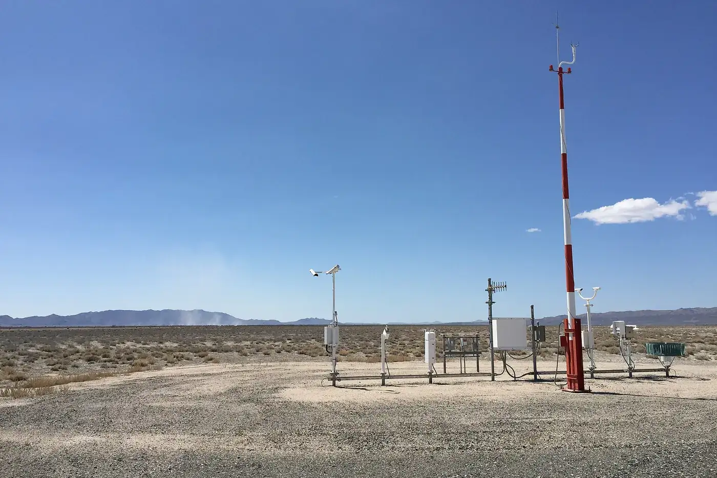
Automated Surface Observing Systems (ASOS) and Automated Weather Observing Systems (AWOS) are critical for aviation and weather forecasting, providing vital surface observations, but they differ in their capabilities and primary uses.
ASOS vs. AWOS Weather Stations: The Data You See
When you research past weather, you will often see data from two kinds of station: Automated Surface Observing Systems (ASOS) and Automated Weather Observing Systems (AWOS). Both are automated weather stations. Both report key weather conditions, mainly for aviation and forecasting. But they differ in their sensors, how they report, and who runs them.
What Are ASOS and AWOS Stations?
ASOS (Automated Surface Observing System) is the main surface weather network in the United States. Three agencies sponsor it together: the National Weather Service (NWS), the Federal Aviation Administration (FAA), and the Department of Defense (DoD). ASOS stations report a full set of weather data:
- Sky condition (cloud height and amount)
- Visibility
- Present weather (rain, snow, fog)
- Temperature and dew point
- Wind direction and speed
- Air pressure
Many ASOS sites have extra sensors, such as ones for freezing rain or lightning. ASOS stations sit at larger airports. They send a report every hour, plus special reports when the weather changes fast.
AWOS (Automated Weather Observing System) units are mostly put in and maintained by the FAA.
- They are usually less complete than ASOS. But what they can do varies a lot by model (AWOS-1, AWOS-2, AWOS-3, and so on).
- They focus on what pilots need: altimeter setting, wind, temperature, dew point, and density altitude.
- More advanced versions (AWOS-3 and up) can also report cloud height, visibility, and present weather.
- AWOS stations are common at small and mid-sized airports.
Key Differences and Similarities
Both systems give automated weather readings. The main differences:
- Sponsor and purpose: ASOS is a joint effort for general forecasting and aviation. AWOS is mainly an FAA system for aviation safety at airfields.
- How much they measure: ASOS usually reports more, including detailed sky conditions and present weather. That makes it a cornerstone of NWS forecasts. AWOS, mainly older versions, may have fewer sensors.
- How often they report: Both usually take readings every minute. ASOS sends full coded METAR reports about hourly, with special reports for fast changes. AWOS can report more often in some cases.
- Where they are: ASOS sits at major airports and key sites across the country. AWOS units are more numerous and spread across more small and regional airports.
Both share one goal: accurate, real-time surface weather from automated sensors. This cuts the need for human observers, though people can still add to the data, mainly at ASOS sites.
How StormAuditor Uses Station Data
StormAuditor uses surface station data, including ASOS and AWOS readings, in its weather history.
- Wind: When we analyze wind for a property-level historical weather report, nearby stations add useful context. This helps most with peak gusts and sustained wind speeds. Our Storm Auditor Wind Estimate (SAWE-2) starts from the NWS analysis of record (URMA). It then corrects it with this measured station data and NWS Local Storm Reports marked as measured.
- Point readings: A station is very accurate for its own spot. But weather, mainly severe weather like microbursts or hail swaths, can change a lot a short distance away. StormAuditor handles this by combining many sources.
- Hail: ASOS and AWOS usually do not report hail size. They can show that precipitation fell. StormAuditor adds radar Maximum Estimated Size of Hail (MESH) data through our Storm Auditor Hail Estimate (SAHE-2) for a fuller picture.
Limitations
ASOS and AWOS stations give key data, but they have limits:
- They are point readings. A severe event, like a downburst or heavy hail, can happen between stations and go unmeasured.
- Station wind data can miss local events like microbursts. The true peak gust at a property between stations can be higher than reported.
- Station reports alone cannot map the exact path of the hail or wind swaths that hit properties.
That is why StormAuditor adds radar data and storm reports to build a fuller estimate. Learn more about our methodology and limitations here.
Related StormAuditor Tools
- Property-Level Historical Weather Report
- Wind Explorer
- Hail Explorer
- Date of Loss Weather Research
- All Data Sources StormAuditor Uses
FAQ
Q: Can ASOS/AWOS tell me the exact hail size at my property?
A: No. These stations have no sensor that measures hail size. They can report that precipitation is falling. They may flag hail if a person is on site or if certain sensors detect it, which is rare for hail size. For hail size, StormAuditor relies on radar MESH data and storm reports from people. See our Hail Explorer for more.
Q: Are ASOS/AWOS gusts accurate for a place miles away?
A: Automated stations measure wind very accurately at their own location. But wind, mainly in severe weather, can change a lot over short distances. A microburst can hit a very small area with damaging winds. A station a few miles away could miss it entirely. StormAuditor's SAWE-2 handles this by using many data sources.
Q: Which agency maintains ASOS stations?
A: ASOS is a joint effort of the National Weather Service (NWS), the Federal Aviation Administration (FAA), and the Department of Defense (DoD). That keeps the data widely available and useful for both aviation safety and general forecasting.
Q: Do these stations ever make mistakes?
A: Automated systems are very reliable, but errors happen. A broken sensor, or heavy ice on a wind sensor, can cause bad readings. Meteorologists, and StormAuditor's algorithms, run quality control checks to find and filter out bad data.