NEXRAD Radar Basics: Understanding How Storm Radar Works
By StormAuditor Editorial Team · Published 2026-07-16 · Updated 2026-08-11
Based on public NOAA and National Weather Service records, published under StormAuditor's methodology and data-source standards. Radar-derived hail sizes are estimates unless attributed to a ground report.
Damage-threshold ranges in this article are general guidance synthesized from industry and federal research — IBHS building-performance research, NWS severe criteria, and product standards such as UL 2218 (hail impact resistance) and ASTM D3161/D7158 (shingle wind ratings). Actual performance depends on product rating, age, installation quality, exposure, and impact characteristics — thresholds describe when damage becomes possible, not when it occurs.
NEXRAD (Next-Generation Radar) is the backbone of severe weather detection, providing crucial data on approaching storms. Understanding how this advanced Doppler radar works can help property owners, contractors, and adjusters interpret storm reports and historical weather data more effectively.
NEXRAD Radar Basics: How Storm Radar Works
NEXRAD (Next-Generation Radar) is key to finding and tracking severe weather, including hail and high winds. If you research past storm damage at a property, it helps to know how this radar works. It helps you read weather records and services like StormAuditor.
What Is NEXRAD Radar and How Does It Work?
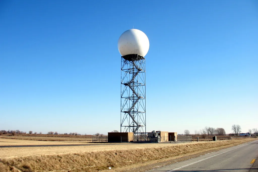
NEXRAD is a network of 160 high-resolution Doppler weather radars. The National Weather Service (NWS) runs them across the United States.
- Each radar sends pulses of energy into the sky.
- The pulses hit rain, snow, hail, or other targets like insects or dust.
- Some energy bounces back to the radar dish.
- This "echo" tells meteorologists what is going on inside the storm.
Doppler weather radar gathers two main kinds of data:
- Reflectivity: How strong the returned signal is. It depends on the size, shape, and amount of rain, snow, or hail in the storm. Higher reflectivity usually means heavier precipitation. That can mean heavy rain or, what matters most for property damage, larger hail. For example, a very high reflectivity core may point to hail above the severe level of 1.00" (quarter size).
- Velocity: How fast the particles move straight toward or away from the radar. From these Doppler shifts, meteorologists work out wind speed and direction inside a storm. They can spot rotation that hints at a tornado (EF0 tornado range 65-85 mph, severe wind threshold 58 mph). They can also spot damaging straight-line winds.
Today's NEXRAD radars are also dual-polarization. They send and receive both horizontal and vertical pulses. This adds detail on the type of precipitation (rain, hail, snow), its size, and its shape. It helps tell heavy rain from large hail. It also improves hail size estimates like the ones in StormAuditor's method.
How StormAuditor Uses NEXRAD Data
StormAuditor uses NEXRAD data for property-level weather history.
Hail. StormAuditor's SAHE-2 (Storm Auditor Hail Estimate v2) mainly uses MRMS MESH (Maximum Estimated Size of Hail) from Hail Explorer. MESH is an advanced product built from NEXRAD data. It gives a hail size estimate for each grid cell along a storm's path. These swaths are key for checking whether a property saw hail at or above the severe level of 1.00" (quarter size), or even the significant severe level of 2.00" (hen egg).
Wind. NEXRAD velocity data is key for severe thunderstorm and tornado warnings. But StormAuditor's SAWE-2 (Storm Auditor Wind Estimate) method focuses on NOAA ASOS/AWOS station peak-gust archives and model background winds. It checks these against SPC storm reports of measured gusts. Peak gusts between stations can be higher than reported, and stations can miss microbursts.
Warnings. The NWS and NOAA issue severe thunderstorm warnings (for winds of 58 mph or more, or hail of 1.00" or more) and tornado warnings using live NEXRAD data. StormAuditor tracks these as the official record of a property's warning history, through IEM (Iowa Environmental Mesonet) archives.
When you use our Address Lookup tool, StormAuditor processes past NEXRAD-based data. It checks whether your property fell inside estimated hail swaths or severe warning areas. NEXRAD gives ESTIMATES of severe weather, not direct measurements at every point. StormAuditor combines it with other reliable sources for the most complete picture possible.
Practical Guidance for Property Owners, Contractors, and Adjusters
Knowing how NEXRAD works helps you read weather history, mainly for date-of-loss research [/date-of-loss-weather-research].
- Property owners: Say a StormAuditor report shows your property inside a radar hail swath of 1.25" (half-dollar size) or 1.75" (golf ball size). That suggests functional hail damage is quite likely, mainly to asphalt shingles. It can guide your talks with contractors and adjusters. Asphalt shingles often begin to show functional damage from hail about 1.00" to 1.25" across. Window and skylight breakage becomes common at about 1.75" and larger.
- Contractors: Radar data from StormAuditor's Hail Explorer and Wind Explorer explorers helps you decide which inspections come first. It also lets you check the damage you see against how strong the storm was. For example, a 2.00" (hen egg) hail swath over an area makes serious roof and property damage much more likely.
- Adjusters: NEXRAD-based data plus SPC storm reports gives a strong base of evidence for claims. Our reports can help confirm whether severe hail (1.00" or more) or damaging wind (58 mph or more) was present at one place and time. That speeds up claims. On aged or poorly fastened asphalt roofs, shingles can lift with gusts of 46–57 mph; shingle loss is possible from 58 mph, and widespread roof-covering loss is possible from about 74 mph.
Limitations
NEXRAD is very advanced, but it has limits:
- Radar can under-estimate hail size, mainly for wet hail. It can over-estimate in very strong reflectivity cores.
- The beam spreads with distance, so data far from the radar is less precise.
- Ground clutter and weather conditions can also affect data quality.
StormAuditor reduces these limits by combining several sources. We give estimates, not direct measurements, and we never claim to "prove" what caused damage. Our goal is accurate weather history. See our Limitations page for more.
Related StormAuditor Tools
- Property-Level Historical Weather Report
- Hail Explorer
- Wind Explorer
- Date-of-Loss Weather Research
- StormAuditor Methodology
FAQ
Q: What is NEXRAD radar, and what does it detect?
A: NEXRAD (Next-Generation Radar) is a network of Doppler weather radars run by the NWS. It finds precipitation, measures how strong it is (reflectivity), and tracks how it moves (velocity). That lets meteorologists follow storms and spot severe weather like hail (1.00" or larger) and damaging wind (58 mph or more).
Q: How does StormAuditor use radar data for hail?
A: StormAuditor's SAHE-2 uses NEXRAD-based products like MRMS MESH to estimate the Maximum Estimated Size of Hail (MESH) at a property. This shows whether the property saw hail at severe levels, such as 1.00" (quarter size) or 2.00" (hen egg).
Q: Can NEXRAD radar tell me if my roof was damaged?
A: Radar data can show whether severe weather, such as hail of a certain size or strong wind, likely hit your location. That is key context. It cannot assess property damage directly. That takes a qualified inspector, who can use a StormAuditor report as part of the assessment.
Q: Are radar hail size estimates always accurate?
A: No. Radar hail sizes are estimates. Wet hail or complex storms can lead to under- or over-estimates. StormAuditor checks the radar estimate against ground reports within 3 miles of the property.
Q: What is "dual-polarization" radar?
A: Dual-polarization is an upgrade to NEXRAD radar. It sends and receives both horizontal and vertical pulses. This adds detail on precipitation type (rain, hail, snow), size, and shape. It greatly improves the ability to tell large hail from heavy rain.